Our Services
Providing accurate and reliable land survey and transaction solutions.
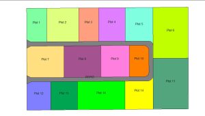
Plot Subdivision
Dividing a registered land parcel (thram plot) into two or more plots, each assigned a new
plot number,
area, and
boundary.

Topographic Survey
Mapping the
natural and man-made features of the land, along with its
elevations and
contours to aid planning and construction.
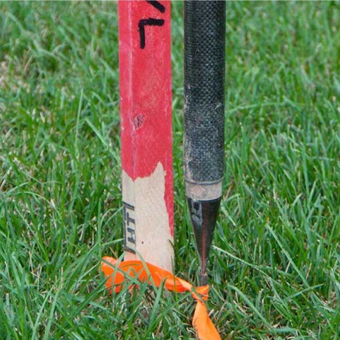
Boundary / Structure Stakeout
Marking precise locations on the ground according to design plans, property boundaries, or construction layout.
- ✔
Land Survey Services using Latest TechnologyHigh-precision surveys using modern instruments and advanced technology.
- ✔
Lag Thram Transfer ServicesSeamless assistance with land ownership transfers and documentation.
- ✔
Legal AdviceProfessional guidance on land laws and regulations with compliance requirements.
- ✔
Land Transaction FacilitiesSupport for secure and efficient land transactions.
- ✔
Cadastral SurveyPlot Fragmentation: Accurate division of land parcels according to standards and client needs.
Boundary Demarcation: Clear and authoritative marking of property boundaries accurately.
- ✔
Topography SurveysDetailed mapping and terrain analysis for planning, development, and landscaping.
- Control Survey
- Detail Survey
- Contour Survey
- ✔
Engineering Survey- Building Layout
- Stakeout Survey
- Leveling Survey
- ✔
Drafting of Official & Private DocumentsPreparation and drafting of legal, official, and private documents in compliance with the law.